rapidtransit.net
book review
Tracks of the New York City Subway
by Peter J. Dougherty
Reviewed by Paul Matus Page 3
For
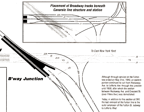
clarity, Dougherty gives us two views of Broadway Junction on the
BMT, so we miss none of the detail. Tracks of the New York City
Subway
But Wait! There's More!
If you
need even more convincing that the paper copy is worthy of consideration,
Dougherty piles on additional goodies for the interested
reader.
His introduction gives a basic
primer of the New York City subway system and a short outline of its
history, touching base on the two largest events to impact the system in
the last 60 years, "Unification," in which the City of New York took over
the private systems, and "Chrystie Street," the lower Manhattan track
connection that integrated large parts of the old BMT and IND
systems.
Dougherty
explains how track numbering is done, and how
directions are determined on the system. In a separate section, he explains how
"chaining" works. Chaining is the system by which locations on the
system are described with accuracy. The letters and numbers you see on a plate
attached to each signal on the system can actually tell you what line
you're on and how far you are from a fixed location, known as "chaining
zero." Not to leave the reader to up in the air, Doughery provides a
listing of all the chaining letters on the system, where the zero points
are located, and the differences between BMT/IND and IRT signal coding
methods.
If you're one of the folks who likes
to listen in to know the "secret" doings of the system, Dougherty includes
the radio frequencies of each division, police frequencies, the meaning of
the "12" codes used in radio conversion (e.g., "12-12" is a disorderly
passenger) and the interpretation of the train operators' horn or whistle
signals.
There's also a glossary of the most
common jargon. What's that striped board called that hangs over the
platform, visible from the track side? (It's a Conductor's Board.) What's
OPTO? And when is a train "foul"?
A few extra curiosities round out the book. A track map of the
Bronx portion of the 3rd Avenue el, closed in 1973, another of the Culver
Shuttle, closed in 1975. The track plan of the South Brooklyn Railway's
freight connection to the Cross Harbor Railway. And for those with an eye
to the future, the track plan of the new 63rd Street tunnel line and its
connection with the IND Queens Boulevard Line.
And just for good measure, there are simple track plans of the Staten
Island Rapid Transit line and of the underground portions of the Port
Authority's subway-like PATH line to New Jersey, the former Hudson & Manhattan
Railroad.
So What
Isn't in the Book?
After describing all the detail is
this unusual work, you might wonder what could possibly be
missing.
Most obvious is that
there is no service guide. Though each station is keyed with the letters
or numbers of the usual services at that station, there is no unified
description of routings and times of service. A possible reason to
not provide this information is that service changes can be
fairly frequent (if minor) and might unnecessarily obsolete a particular
edition of the book. Also, the Metropolitan Transportation Authority's
official map (called The Map) is detailed and easy to use and is
a good companion to this book. It's also available free and updated
frequently, and is probably one of the best free transit maps in
existence, covering the commuter lines as well as the
subways.
It would be nice
to have color coded tracks, to make the complex junctions even more
readable, as well as to emphasize in-service and not-in-service tracks. It
is a good guess, though, that the extra cost of color might make the
cost of the book prohibitive.
Finally, there
is a personal favorite I would like to see included. Dougherty includes
the track numbers, helping us follow different routings. As
previously mentioned he explains the "chaining" system, but he
doesn't include the chaining measurements at
key points, such as at switches and stations. These numbers would be an invaluable
resource for the understanding of distances and locations on the
system, as well as a useful research tool.
Is this Book for You?
By this point in the review
you've probably answered the question for yourself. If the level of detail
presented makes you wonder why anyone would want to know that
much about the New York City subway system, you won't be a buyer. But
if you can picture yourself spending happy hours tracing tracks and
routes, the book is a "must-have."
Illustrations in this review are ©1999 by Peter Dougherty.
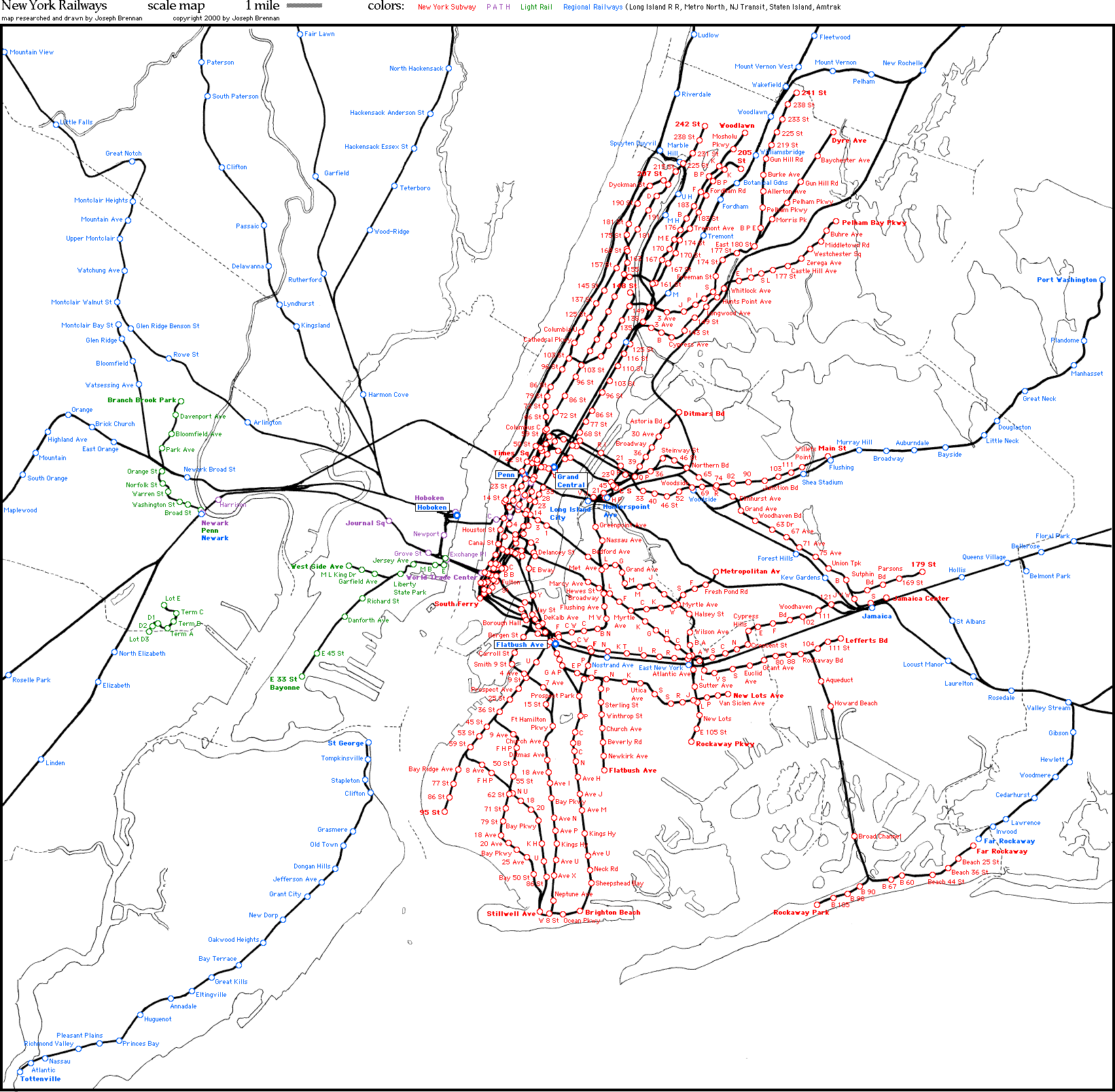
| Links to Route Maps: |
Joseph Brennan's NYC
Area Subway/RR/Rail Transit Diagram |
|
3 |
Return to Book Review
Home
Return to rapidtransit.net Home
Everything on this site is copyright 2000 by The Composing Stack
Inc., except as otherwise noted.
Materials with other copyrights are
used by permission.
All rights reserved
Last updated April 15, 2000